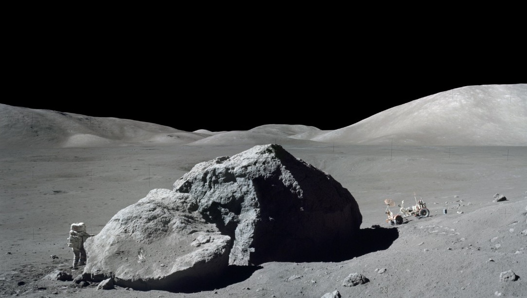
Credit: Apollo 17 Preliminary Science Report.
The lunar regolith is the uppermost layer of fine-grained material on the surface of the moon. It records up to billions of years of our solar system's history on its surface. Definitive evidence shows the presence of hydrogen and volatiles like water-ice in its subsurface. Understanding the thickness of the regolith allows us to constrain the depth at which these resources might be stable. It can additionally tell us where the ground might be littered with large boulders that are potential hazards for future landings.
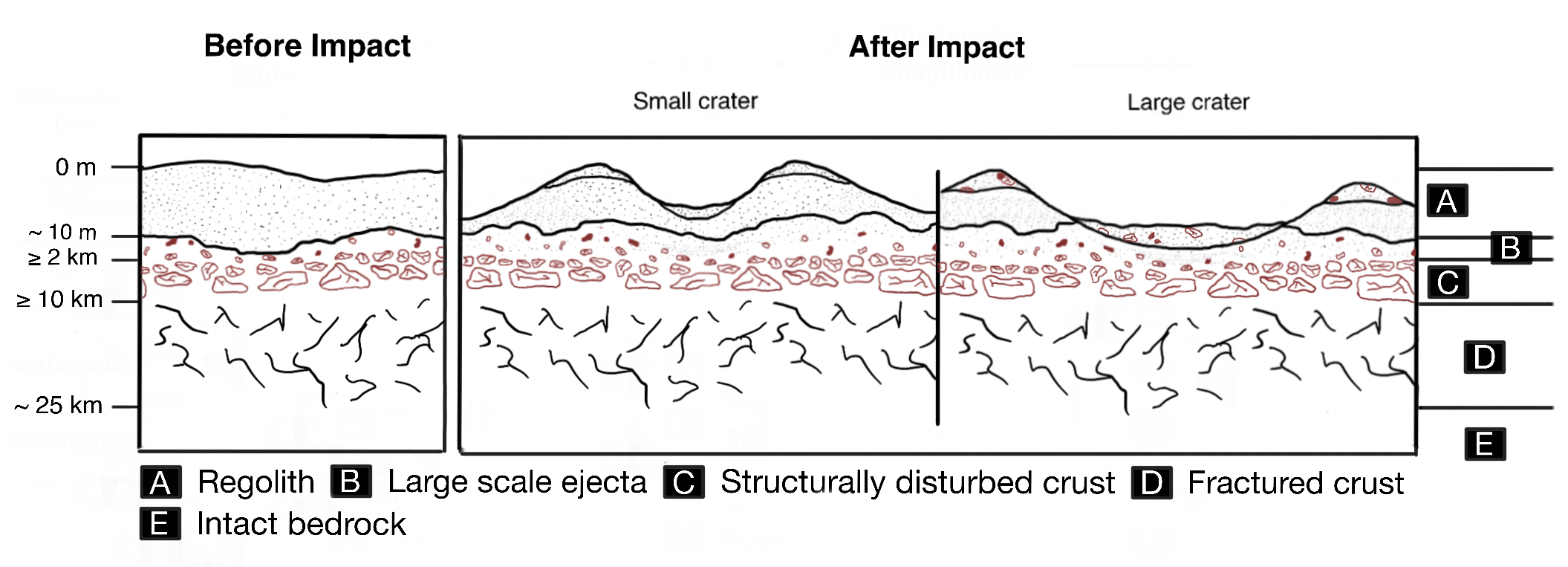
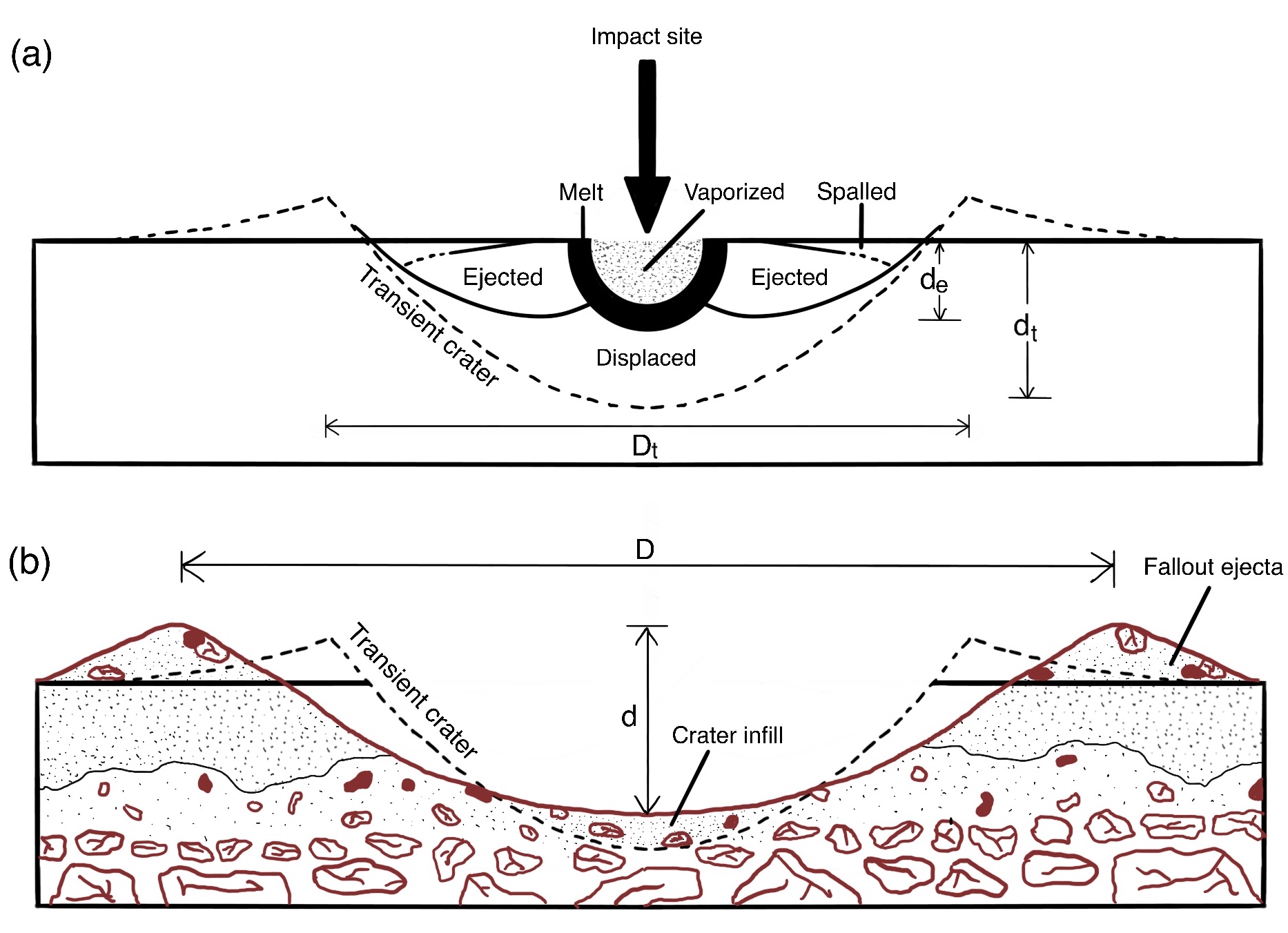
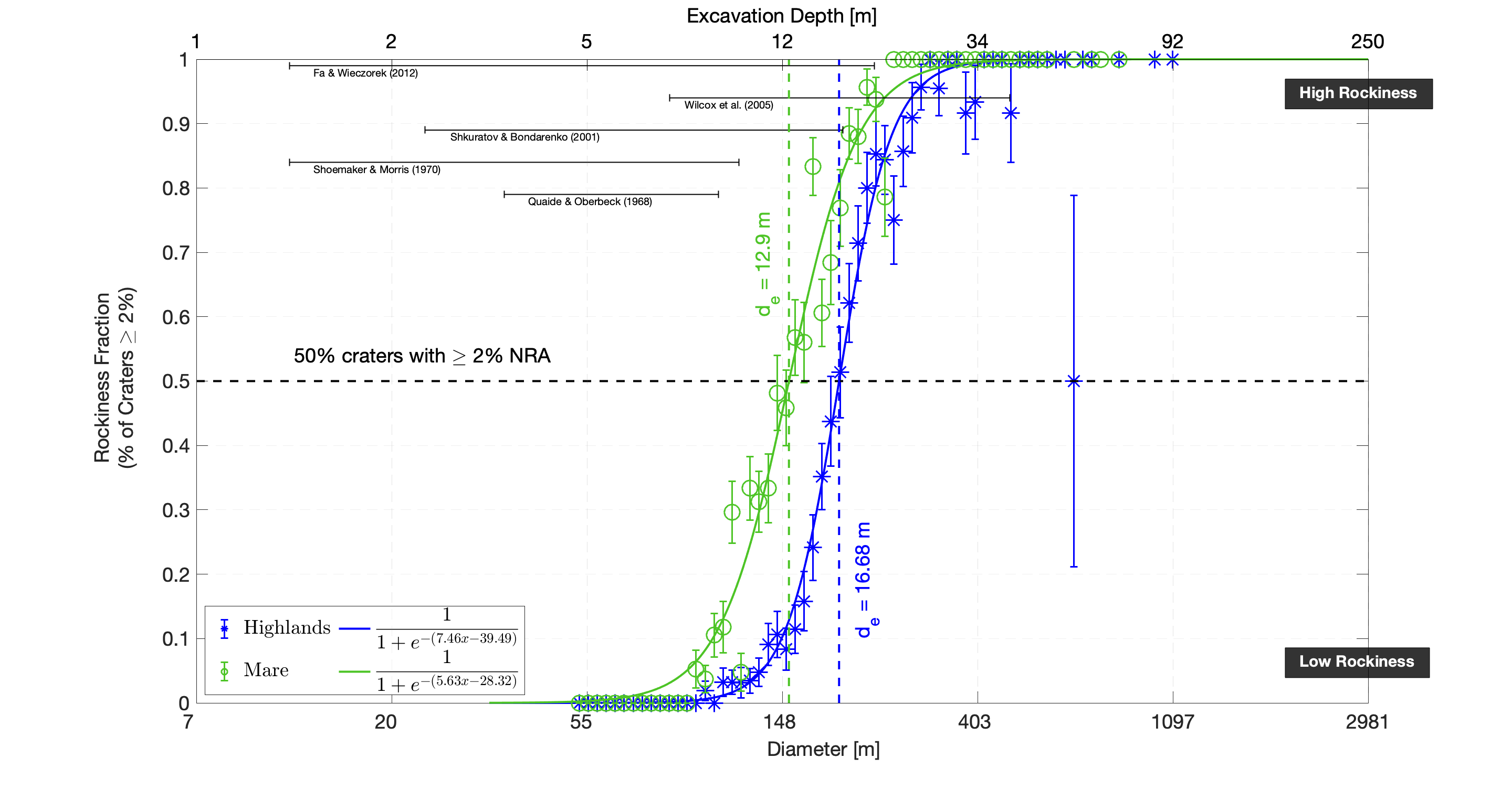
Consolidated rock has a higher thermal inertia than fine-grained regolith. Thus, Diviner surface temperatures can tell us about rock distribution on the lunar surface. In Venkatraman et al. (2022), I calculate regolith thickness statistically, using these rock abundance estimates at cold spot craters which are visibly fresh impact craters surrounded by a large region of reduced nighttime temperatures. The main idea is that small impact craters will excavate only regolith while larger craters will excavate more consolidated rock detectable by Diviner, allowing us to measure lunar regolith thickness as the depth at which these craters excavate consolidated rock.
We quantify depth using models of excavation depth from Melosh (1989). Our recently updated results show that 50% of craters are rocky at excavation depths of around 13 m and 17 m in the mare and highlands respectively. Lunar mare craters seem, on average, to become rocky at slightly shallower depths than those on the highlands.
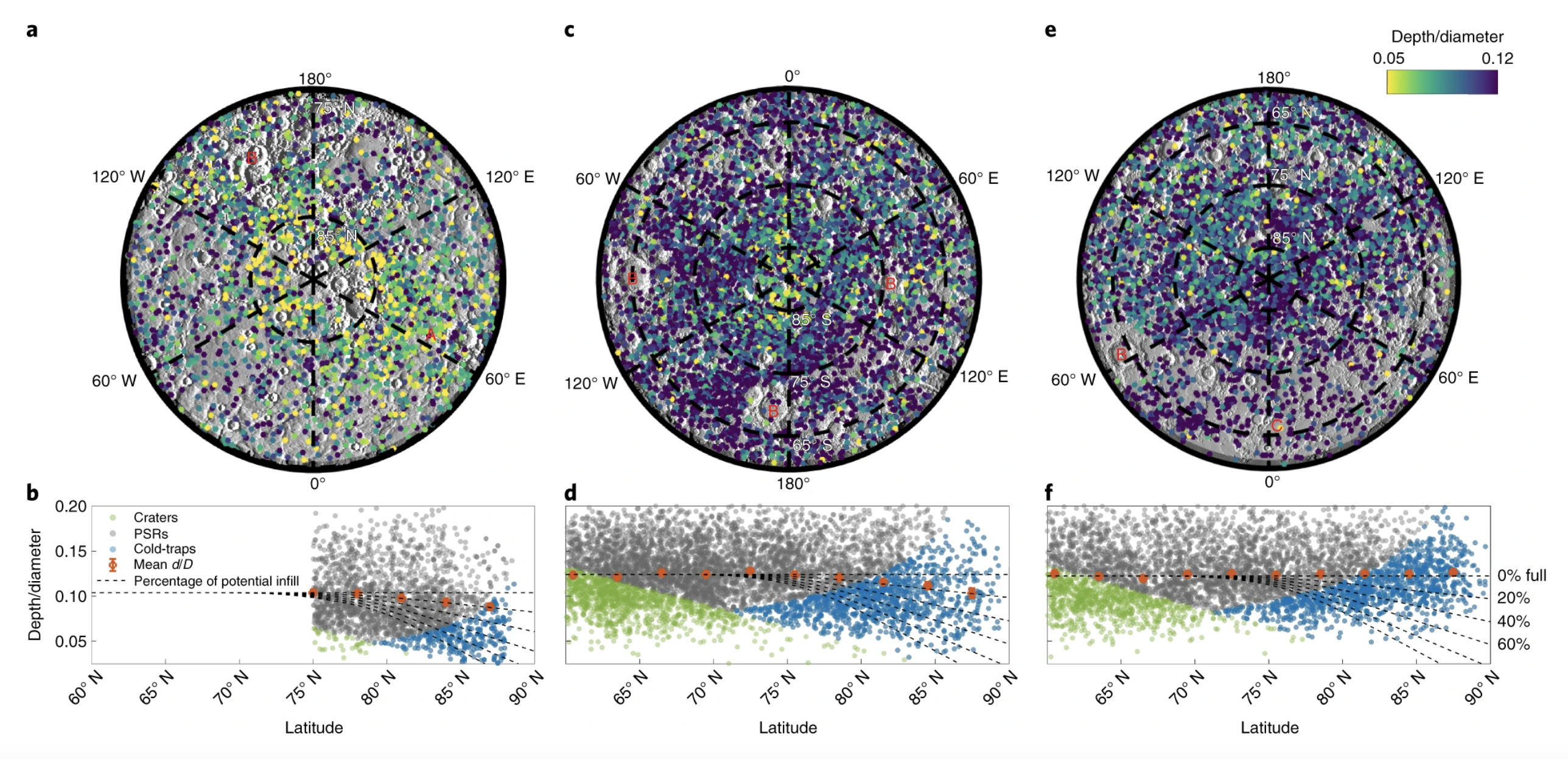
While an undergrad, I worked on creating a database of crater depth to diameter ratios on Mercury and the moon for graduate research on shadowed regions and water-ice infill. The results are published in Rubanenko et al. (2019).